 UPDF
 UPDF for Windows
 UPDF for Mac
 UPDF for iPhone/iPad
 UPDF for Android
 Nomostar
 UPDF AI Online
 UPDF Sign
 IvyCraft
 Edit PDF
 Annotate PDF
 Create PDF
 PDF Form
 Edit links
 Convert PDF
 OCR
 PDF to Word
 PDF to Image
 PDF to Excel
 Organize PDF
 Merge PDF
 Split PDF
 Crop PDF
 Rotate PDF
 Protect PDF
 Sign PDF
 Redact PDF
 Sanitize PDF
 Remove Security
 Read PDF
 UPDF Cloud
 Compress PDF
 Print PDF
 Batch Process

 About UPDF AI
 UPDF AI Solutions
 AI User Guide
 FAQ about UPDF AI
 Summarize PDF
 Translate PDF
 Chat with PDF
 Chat with AI
 Chat with image
 PDF to Mind Map
 Explain PDF
 PDF AI Tools
 Image AI Tools
 AI Chat Tools
 AI Writing Tools
 AI Study Tools
 AI Working Tools
 Other AI Tools
 AI Bookmark Generation
 AI Bookmark Summary
 AI Watermark Generation
 AI Background Generation
 AI Sticker Generation
 AI Stamp Generation
 AI Editing Suite
 UPDF Copilot
 AI Page Management
 AI Semantic Search
 PDF to Word
 PDF to Excel
 PDF to PowerPoint
 Enterprise Solution
 Enterprise Sign
 Enterprise AI
 Enterprise Plan
 Enterprise User Guide
 Enterprise Webinar
 IT
 Education
 Construction
 Financial Service
 Healthcare
 Insurance
 Legal
 Manufacturing
 Government
 Researchers & PhDs
 Solopreneurs & Freelancers
 Lawyers & Legal Professionals
 Real Estate Agents & Brokers
 Education Solution
 Customer Stories
 User Guide
 UPDF Tricks
 FAQs
 UPDF Reviews
 Download Center
 Blog
 Newsroom
 Tech Spec
 Updates
 UPDF vs. Adobe Acrobat
 UPDF vs. Foxit
 UPDF vs. PDF Expert


Quick Answer
- Google Earth Pro's built-in save/print — no converter, no upload. Good for a quick map image in a report. Go to Path 1
- Online converters — pick based on privacy, file size, and whether you need vector or raster output. Go to Path 2
- KMZ first, then convert — for large KML files or ones that reference external images. Go to Path 3
- Convert, then annotate — when the PDF needs routes traced, sites circled, or comments added. This is where UPDF fits. Go to Path 4
Search "KML to PDF" isn't looking for a format lecture. You have a map open in Google Earth, and need to send it to someone who doesn't have Google Earth, and also want the result to still look like a map — not a screenshot that turns to mush when the client zooms in.
The problem is that "convert KML to PDF" means three different things depending on your output, and each one needs a different tool.
Besides compatibility, various reasons enable users to convert a KML file to a PDF which ranges from format availability to enhanced security. Hence, once you transform the file into a PDF, using UPDF, a versatile PDF management tool that features various editing features. So, for efficient PDF management, download the tool now and explore its powerful features.
Windows • macOS • iOS • Android 100% secure
Part 1. Which Path Fits Your KML before Coverting?
Before you install anything, find your situation below and pick one path that suits you best.
| Your situation | What you actually need | Go to |
|---|---|---|
| You need a snapshot of the current map view for a report or email, and don't need it sharp when zoomed | Google Earth Pro's built-in save/print — no converter, no upload | Path 1 |
| Your KML is under Google Earth's import limits (roughly 10,000 features or 250,000 vertices) and you want a one-click conversion | An online converter — choice depends on privacy, file size, and output quality | Path 2 |
| Your KML is large, references external images/models, or Google Earth won't load it properly | Package as KMZ first, then convert | Path 3 |
| You need the converted PDF to be editable or annotatable — trace routes, add comments, share for review | A PDF editor after conversion — this is where UPDF fits | Path 4 |
The one-line rule: if the PDF only needs to be looked at, use Path 1 or 2. If the PDF needs to be worked on after conversion, add Path 4.
Path 1: Google Earth Pro's Built-In Export (No Converter Needed)
Use this when: you want a quick map image for a document, and "good enough for a report" is the standard.
This is the path most converter listicles skip, and it's often the right one for simple needs. Open the KML in Google Earth Pro, frame the view you want, then save the image or copy it into a document. That's a raster snapshot — it will blur if someone zooms — but for an email attachment or a printed appendix, it does the job without uploading your file anywhere.
Steps:
- Open the KML in Google Earth Pro (free desktop app).
- Tilt, zoom, and rotate until the map looks the way you want it.
- Use File → Save → Save Image (or Edit → Copy Image to paste into a document).
- Paste into Word/Google Docs and export as PDF, or print directly to PDF.
This is a picture of your screen, not a geospatial PDF. The map won't stay sharp at high zoom, and the text labels won't be selectable. If that matters, move to Path 2.
Path 2: Online Converters — Pick Based on Privacy, Size, and Output
Use this when: you want an actual PDF file, not a screenshot, and your KML is small enough for a browser-based tool.
The online converter space has a real divide that most comparison tables ignore: server-uploaded converters (GroupDocs, Aspose, MyGeodata) versus browser-local converters (Innerscene). The difference isn't marketing — it's whether your geospatial data leaves your machine.
If privacy matters: Innerscene (browser-local, no upload)
Innerscene runs the KML parser and PDF writer inside your browser tab using JavaScript and WebAssembly. Your file never gets uploaded to a server — there is no upload step, no conversion queue, and no copy on anyone else's machine. That matters for client work, anything under NDA, or internal location data you wouldn't email to a stranger.
What it does well: opens KML files up to 200 MB directly, parses without freezing the page, and exports a true vector PDF where lines, arcs, labels, and colors stay sharp at any zoom and remain editable in Illustrator. No watermarks, no account required.
What it doesn't do: it drops layers and structure into a flat export — whatever you have switched off in the Layers panel is simply not drawn, and the output matches your current view rather than rebuilding the full KML hierarchy. If you need every layer preserved separately, this isn't the tool.
If you need coordinate-system control: MyGeodata
MyGeodata is the choice when projection and coordinate system matter — it supports over 3,000 coordinate reference systems and lets you assign or transform the CRS if the input isn't recognized. It also handles batch conversions and outputs GeoPDF, which preserves geospatial referencing so the PDF can be used in GIS-aware viewers.
The catch: the free tier has conversion limits (data volume and number of conversions per month), and exceeding them triggers a one-time payment prompt before the conversion finishes — not after. If you're converting one small file, you'll likely stay under the limit; if you're processing a batch, check the free-plan limits first.
MyGeodata
With this online converter, you can convert over 7,000 coordinate systems, including the most common ones, into PDF. When you transform your file, it gives you a preview of the input data in a dialogue box. Thus, to help learn how to convert KML files to PDF using this tool, here are its brief steps:
Step 1. Open the conversion tool and press the dedicated file upload button to add your target KML file.
Step 2. You'll see the file name and size in a pop-up menu, where you should click the "Next" button to proceed further.
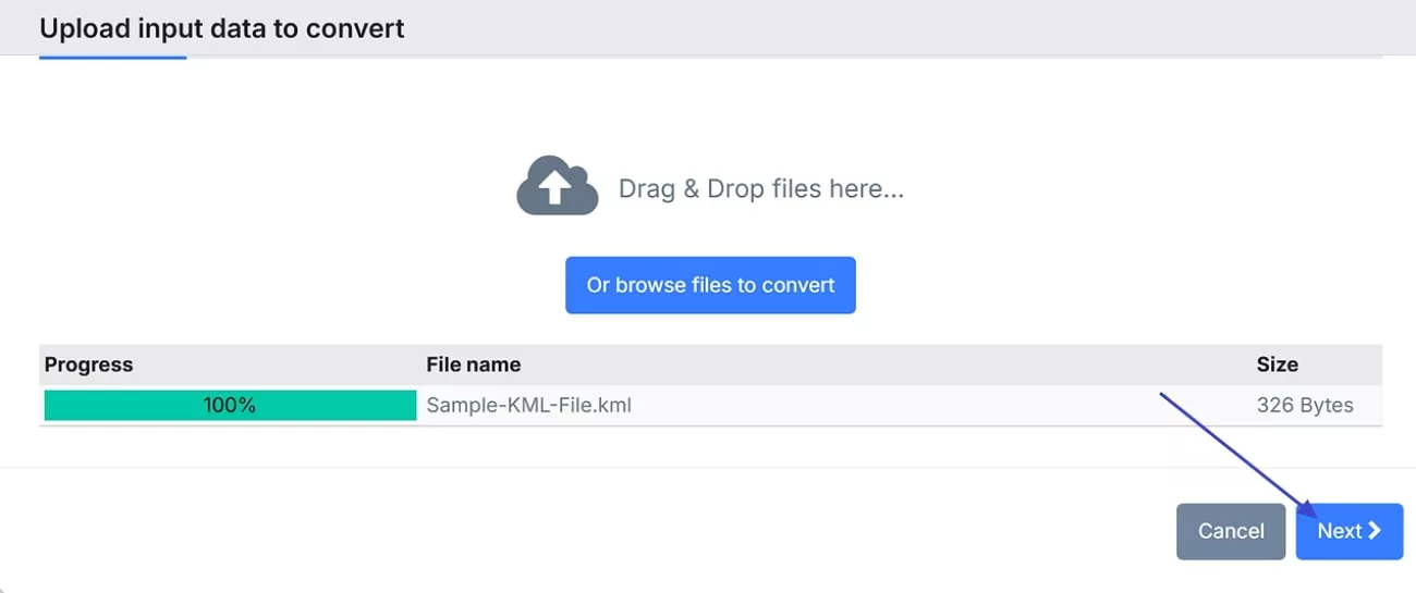
Step 3. Next, confirm the data properties and hit the "Looks Good" button.
Step 4. Press the "Convert" button from the next dialogue box after selecting "PDF – Geospatial PDF (GeoPDF) as the output format and start converting.
Step 5. Next, click the "Download" button to save the converted GeoPDF on your device.
Limitations
- This tool requires many confirmation steps that can tire a user looking for an immediate conversion.
- Plus, the slow process makes it less efficient and wastes users' valuable time.
If you just want the fastest drag-and-drop: GroupDocs
GroupDocs is the no-friction option: no registration, drag and drop, choose PDF, convert, download. It works on any OS with a browser, and it's genuinely fast for standard-sized KML files.
The trade-offs: files are deleted from the server after 24 hours, so you need to download immediately; and the output is a flat PDF without the geospatial referencing that MyGeodata preserves. For a quick one-off conversion where privacy isn't a concern, it's fine. For anything sensitive, use Innerscene instead.
GroupDocs
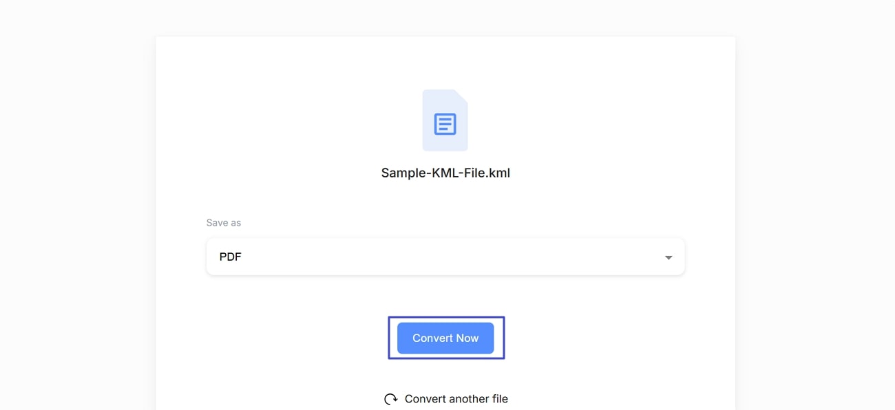
Another converting tool that allows you to transform your KML to PDF without any registration is GroupDocs. Besides PDF, it also supports many different formats and is completely free. Thus, to know how to convert your map-based files, follow the given instructions:
Instructions: Browse the tool and click the "Browse Files" button. After selecting the target format, press the "Convert" button and transform the KML file to PDF.
Limitations
- When you convert the file, it does not open, which makes the tool unreliable for users who need accurate and accessible results.
- Not only this, GroupDocs deletes the data you upload after 24 hours, which leads to the removal of every output file from its server.
The other converters, and what they're actually good at
Aspose is a solid performer for format variety — it converts KML to PDF, PNG, and JPEG, and lets you choose a size option before converting. The limitation is that it only imports from Google Drive and Dropbox in some configurations, which is a problem if your file is on a local drive and you don't want to upload it to a cloud service first. It's also slow with large files.
Aspose
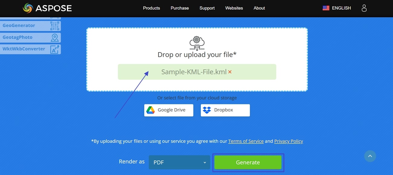
Using this online tool, you can convert KML to PDF and other formats, such as PNG, JPEG, etc. Before you convert the KML file to PDF, this platform allows you to choose the size option to influence the quality of the final file. Follow the simple instructions to utilize Aspose for KML to PDF conversion:
Instructions: Open the tool, press the "Drop or Upload Your File" and import the source KML file. Then, click the "Generate" button to convert your KML file to PDF.
Limitations
- This platform only supports 2 cloud services, which are Google Drive and Dropbox, restricting users who prefer other importing options.
- Besides, the conversion process is quite slow, as it takes time when converting large files.
Quickmaptools is the one to use when you want more control over the output — it exposes options for geometry type, projections, and line separator, and it reads the KML inside a KMZ archive directly. If you're dealing with a KMZ rather than a raw KML, this is a reliable free choice. The interface is not beginner-friendly, and conversions take time.
Quickmaptools
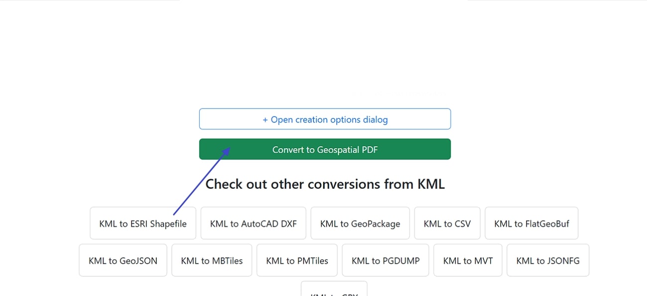
Quickmaptools is another platform that lets you convert KML files to PDF with various options such as Geometry Type, Projections, and Line separator. Other than that, it helps you transform KML files to many other formats like Shapefile, GPX, etc. If you want to learn how to use this tool, the given guide will help you successfully convert KML to PDF with Quickmaptools:
Instructions: Search the tool and press the "Browse Files" button to upload the KML file from your device. Now, press the "Convert to Geospatial PDF" and start the conversion.
Limitations
- The conversion process is slow and might take a while, so if you are the one looking for a fast converting tool, this might not be suitable.
- Plus, the interface is tricky for beginners who are not familiar with tech-based products.
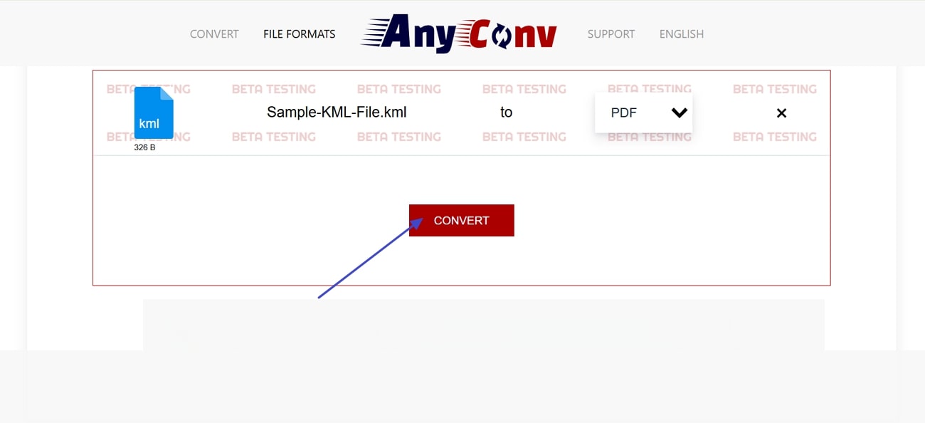
AnyConv is the simplest of the batch — drag, drop, click convert, done. It's fine for a small, non-sensitive file. But the 100 MB cap and the 1-hour deletion window mean you need to download immediately, and large KML files won't fit at all.
AnyConv
With this KML to PDF online converter, you can simply drag and drop your file and transform it with just one click. Besides, with its end-to-end encryption, no one can access your data, and it is totally safe. If you want to convert your KML file into a PDF within AnyConv, follow the given instructions:
Instructions: Search and upload the KML file, press the "Convert" button, and after a few seconds, your file will be converted to PDF.
Limitations
- The maximum file is 100 MB, which limits the user to convert large KML files efficiently.
- Moreover, your files get deleted within 1 hour, so you have to save the file immediately.
Path 3: When Your KML Is Too Large — Use KMZ First
Use this when:
Google Earth's own guidance is explicit: KML/KMZ files with up to 10,000 features or 250,000 vertices import cleanly as map features. Anything larger gets loaded as a data layer — optimized for performance, but not editable. Separately, Google recommends packaging a KML as KMZ when the doc.kml file is larger than 10 KB or when it references external images, models, or textures.
How to make a KMZ: in Google Earth Pro, right-click the KML layer → Save Place As → choose KMZ. Then convert the KMZ instead of the KML.
The one thing KMZ won't fix: if the KML references raster ground overlays or icon PNGs, those may be ignored by converters that only extract vector features — so the PDF may be missing the image layer you expected. Check the output before sending it.
Path 4: After Conversion — What If You Need to Mark Up the Map?
Use this when:
Here's the gap in the converter conversation: once the KML becomes a PDF, you have a static map. If the next step is "show the client which route we're proposing" or "annotate the site boundary before the meeting," the converter has done its job and stopped one step too early.
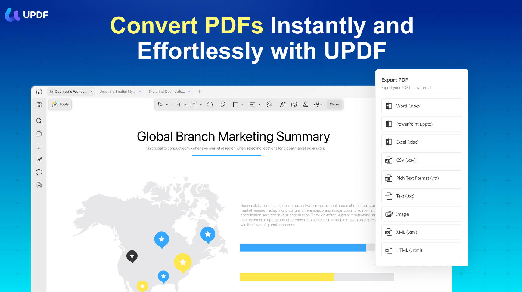
This is where UPDF fits — not as a KML converter, because it isn't one, but as the tool you open after the conversion. The features that matter for a map PDF are specific:
- Freehand drawing and shapes for tracing routes or marking boundaries on top of the map.
- Highlight, strikethrough, and text comments for labeling sites or leaving notes for a reviewer.
- OCR if the PDF is a scanned map with place names that aren't selectable — it makes the text searchable.
- One license across Windows, Mac, iOS, and Android — useful if the person reviewing the map is on a phone.
Check current UPDF pricing and choose the plan that matches your post-conversion needs. If you only need to look at the PDF, skip this section entirely — Paths 1 and 2 already solved your problem.
Windows • macOS • iOS • Android 100% secure
Why UPDF is Ideal for Your KML PDFs?
- Annotate with Ease – Highlight routes, add comments, and draw directly on maps.
Edit Like a Pro – Modify labels, adjust text, and insert additional details effortlessly. - OCR for Text Extraction – Convert scanned map text into searchable and editable content.
- AI-Powered Insights – Summarize, translate, or extract key information instantly.
- Seamless Conversion – Export your PDF into Word, Excel, or other formats for further use.
FAQ
Can I convert KML to PDF without uploading my file to a server?
Yes. Innerscene runs the conversion entirely in your browser using JavaScript and WebAssembly — the file is never uploaded, and there's no server-side conversion queue. It supports KML files up to 200 MB and produces a vector PDF with no watermark. This is the privacy-preserving option.
Why does my converted PDF look blurry when I zoom in?
Because the converter produced a raster PDF (a snapshot of the map), not a vector PDF. Google Earth screenshot exports and many simple online converters work this way. Vector output — from Innerscene or QuickMapTools — keeps lines and labels sharp at any zoom. If zoom quality matters, choose a vector-capable converter, not a screenshot method.
What's the difference between PDF and GeoPDF?
A regular PDF is just a visual document. A GeoPDF preserves the coordinate system and geospatial referencing, so GIS-aware tools can still understand where the map is on the earth. MyGeodata outputs GeoPDF and lets you choose the coordinate system; most simple converters output a flat PDF without georeferencing. If the PDF will be used in GIS software later, choose GeoPDF.
Is GroupDocs safe for sensitive KML files?
It's a server-upload converter: your file is uploaded, converted, and deleted after 24 hours. That's reasonable for non-sensitive data, but it is still an upload. For anything under NDA or client confidentiality, use a browser-local converter like Innerscene instead, where the file never leaves your machine.
Do I need a PDF editor after converting KML to PDF?
Only if the next step is editing or annotating the map — tracing a route, adding comments, marking a site, or sending it for review. If you just need to view or share the PDF, the converter already did the job. If you do need annotation, a PDF editor with freehand drawing, shapes, and comments (like UPDF) covers the post-conversion step.
Conclusion
In conclusion, converting KML to PDF is essential when you need to share or edit it. Therefore, we have provided you with many paths that allow you to convert your KML file easily. After converting it to PDF, if you need to manage that file, you can use a versatile tool, UPDF, that allows you to edit and annotate. So, if you want to download that tool, click the button and start editing.
Windows • macOS • iOS • Android 100% secure




 Enola Davis
 Lizzy Lozano
 Enid Brown